
google geographic charts and maps
| 开发者 | schrax |
|---|---|
| 更新时间 | 2016年11月21日 05:57 |
| 捐献地址: | 去捐款 |
详情介绍:
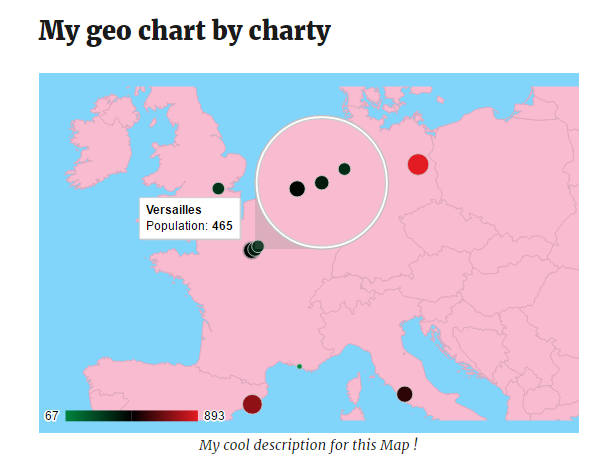
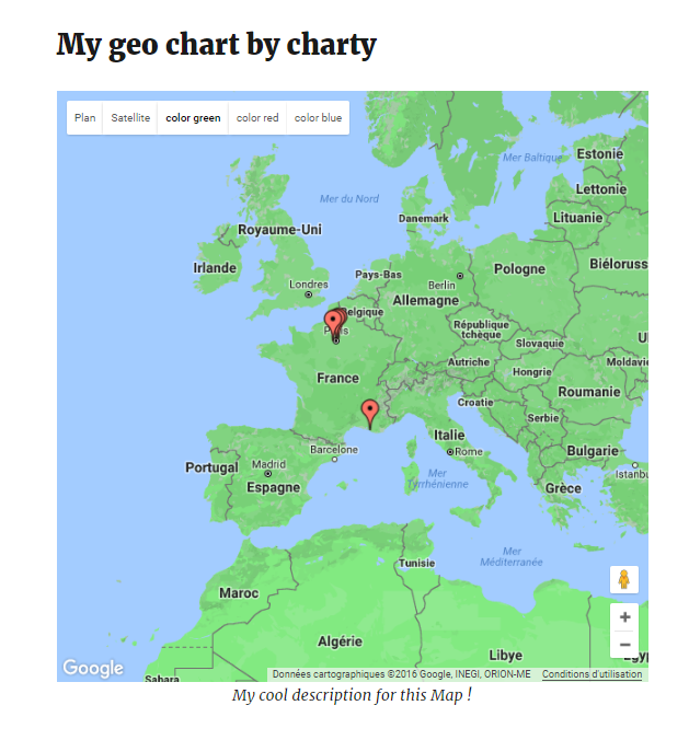
Create and manage google geographic charts and maps. It's a useful tool to display demographic data on geographic charts but also on google maps (there is a Map display mode).
You can also customize your geographic charts (title, content, context, background, color gradient...).
Charty is a super powerful tool for adding beautiful and customizable google geographic charts and maps to your website.
this plugin is made especially for displaying demographic data on maps and google geo charts.
To insert a geographic chart or a map created with the Charty plugin you can directly click on the listbox button added automatically in the Wordpress editor !
IMPORTANT: You will FIRST need to go to your google developper console and add your own Google Maps API key.
Got any feedback or question? Contact us via contact{at}pa-bru.com.
** It's really easy. Get started in 2 minutes tops, no training needed! **
2 Display Modes
Visualise your demographic and localized data in different ways. Each of them animated, fully customisable and look great, even on retina displays.
* Google Geochart mode
* Google Maps mode
Simple and Flexible
Charty uses the Google Charts and Maps API. It means geocharts and maps are built on a powerfull service which is fast and offers loads of customisation options.
Features Coming Soon
- a charty widget
- Color palette themes for quick stylish data
- Plugin Options for extensive chart control by setting your own sensible defaults
屏幕截图:
常见问题:
Can I insert several charts with charty on the same page ?
Yes. It is possible since the 1.2 version of Charty !
更新日志:
1.2
- You can now add and display several charts on the same page.
- fix problem with color axis (for geo charts). It is now optional
- Added height parameter. Now you can choose a height for your chart box.
- Initial Version