GeoFlickr
详情介绍:
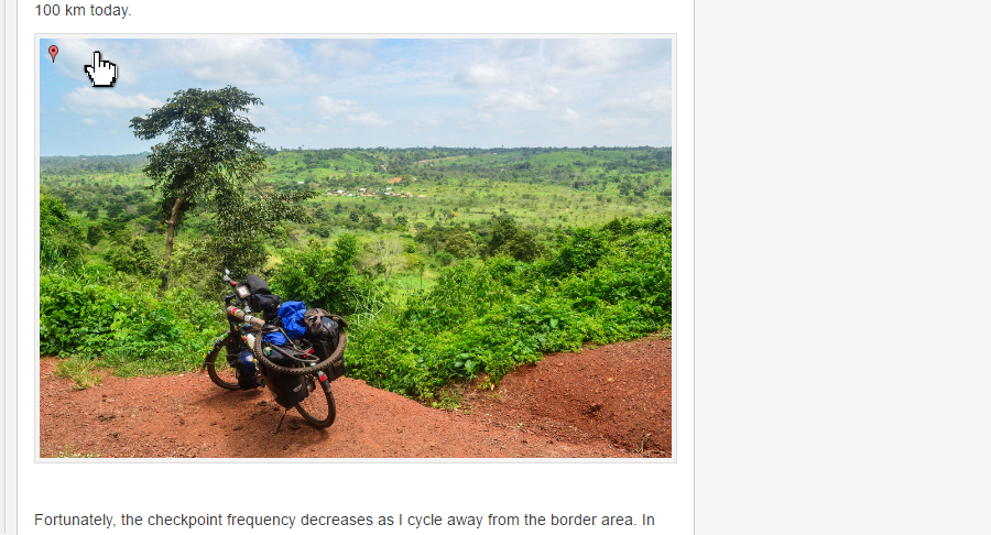
GeoFlickr is a Wordpress plugin that displays a map of the location where the photo was taken, for all embedded Flickr photos that contain GPS coordinates.
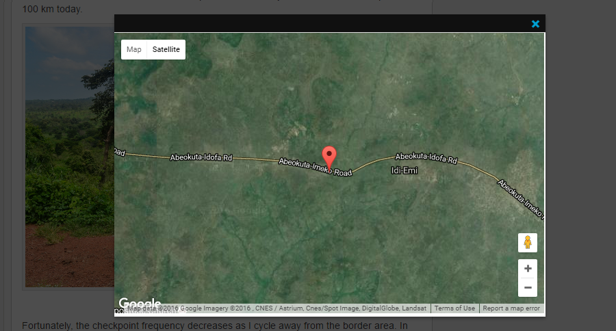
For every photo in a wordpress post/page that is hosted on Flickr, this plugin adds a small red balloon in the top left corner when the mouse is hovering over the photo. If the photo is geotagged on Flickr, meaning it contains GPS coordinates in the EXIF metadata, a click on the balloon displays a pop-up featuring a Google Satellite map of the surroundings.
GeoFlickr features:
- very discrete overlay on the image
- jQuery and thickbox
- Most calls to the Flickr API are done on the client side - so there is minimal additional load or delay on the server
- If your photo has geo-location data embedded, shows it as a marker on Google map with reverse geo-location to fetch the place name
- HTTPS compatible
安装:
- Install from your Wordpress site by adding a new plugin, search for GeoFlickr
- Upload the file geoflickr.zip into the '/wp-content/plugins/' folder of your Wordpress installation
- Unzip the plugin to create the GeoFlickr folder
- Activate the plugin through the 'Plugins' menu in WordPress
屏幕截图:
更新日志:
1.41 (20241217)
- Tested with Wordpress 6.7.1
- Fix unwanted behavior with caching
- Tested with Wordpress 6.6
- Security fixes
- Tested with Wordpress 6.2
- Added customization parameters: height offset, excluded classes
- Made Thickbox responsive for narrow and mobile browsing
- Hidden scrollbars on the Thickbox while the Google Map is loading
- Tested with Wordpress 6.1.1
- Updated API call to Google Maps
- Added handling of response cases from the Flickr API
- Tested with Wordpress 5.8
- Ensured compatibility with lazy-loaded images
- Added a loading wheel before the map is displayed
- Tested with Wordpress 5.0.1
- Fixed map not loading when _content is empty
- Fixed old variables calls with up-to-date ones that support HTTPS
- Fixed links to Flickr since it enforced HTTPS

