
Listdom KML Addon - Display KML Layers
| 开发者 | webilia |
|---|---|
| 更新时间 | 2026年5月21日 22:46 |
| 捐献地址: | 去捐款 |
| PHP版本: | 7.4 及以上 |
| WordPress版本: | 6.9 |
| 版权: | GPLv2 or later |
| 版权网址: | 版权信息 |
详情介绍:
Listdom KML Addon extends the Listdom directory plugin by allowing you to overlay custom map layers using KML or GPX files. This means you can draw boundaries, routes, and shapes on your listing maps to highlight specific areas (like neighborhoods or service zones). Use this add-on to define regions or paths on maps – perfect for real estate listings, travel directories, delivery coverage maps, and more.
Once installed, a Map Layers section will be added to Listdom’s admin panel. There you can create new layers by either uploading .kml/.kmz or .gpx files, or by linking to external KML/GPX file URLs. You can create multiple layers and assign them to any Listdom map view or shortcode, allowing you to display one or several KML/GPX overlays on your maps. The add-on supports all map providers that Listdom works with (Google Maps, OpenStreetMap/Leaflet, etc.), so your KML overlays will display regardless of the chosen map engine. You can also toggle whether these custom layers appear on individual listing detail page maps or only on broader directory maps, giving you control over where the overlays are shown.
Key Features:
- Upload KML files and display them as custom map layers
- Link to external KML or KMZ file URLs (no need to upload if already hosted)
- Support for GPX files (upload GPS tracks or link to GPX URLs as layers)
- Create multiple map layers and assign any combination of layers to Listdom maps
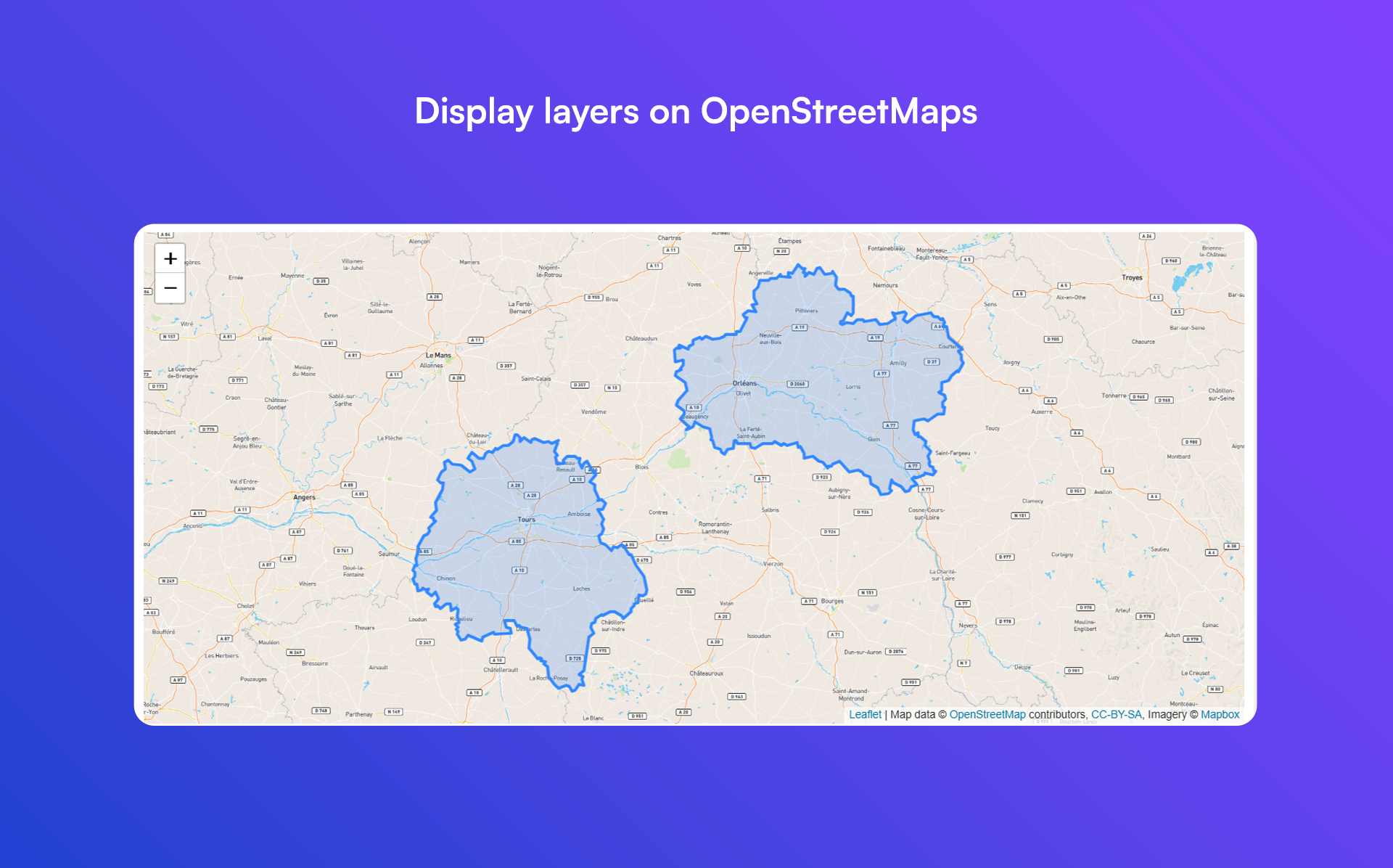
- Highlight areas, boundaries, routes, or shapes on Google Maps or OpenStreetMap seamlessly
- No coding required – simply add your KML/GPX files and Listdom handles the rest
安装:
- Upload the plugin folder to
/wp-content/plugins/(or install via Plugins → Add New in WordPress by searching "Listdom KML Addon"). - Activate the Listdom KML Addon through the Plugins menu in WordPress.
- Make sure the Listdom directory plugin is installed and active (this add-on requires Listdom to function).
- Navigate to Listdom → Map Layers in your WordPress dashboard to add your KML/GPX layers. Create a new layer by uploading a KML/KMZ or GPX file, or by entering the URL to an external file. Save the layer and assign it to your Listdom map shortcodes as needed.
屏幕截图:
更新日志:
2.3.0 - May 13th, 2026
- Added Italian translation.
- Maintenance updates.
- Maintenance updates.
- Minimum required PHP updated to 7.4.
- Fixed some issues.
- Addressed some background issues.
- Initial public release on WordPress.org
- Add and manage custom map layers using KML, KMZ, and GPX files
- Upload files directly or provide external file URLs
- Full support for GPX routes and waypoints
- Display custom shapes, boundaries, and paths on Listdom maps
- Works with all Listdom-supported map providers (Google Maps, OpenStreetMap, etc.)
- Create unlimited map layers and assign them to shortcodes and map views
- Assign multiple layers to the same map for advanced overlays
- Integrated “Map Layers” admin menu in Listdom dashboard
- Compatible with all official Listdom addons
- Manage the layers visibility on the maps of the single listing page
- No coding required – fully handled via WordPress admin