Municipal Boundaries
| 开发者 | yiannisdesp4 |
|---|---|
| 更新时间 | 2020年8月4日 15:45 |
| PHP版本: | 5.4 及以上 |
| WordPress版本: | 5.4 |
| 版权: | GPLv2 or later |
| 版权网址: | 版权信息 |
详情介绍:
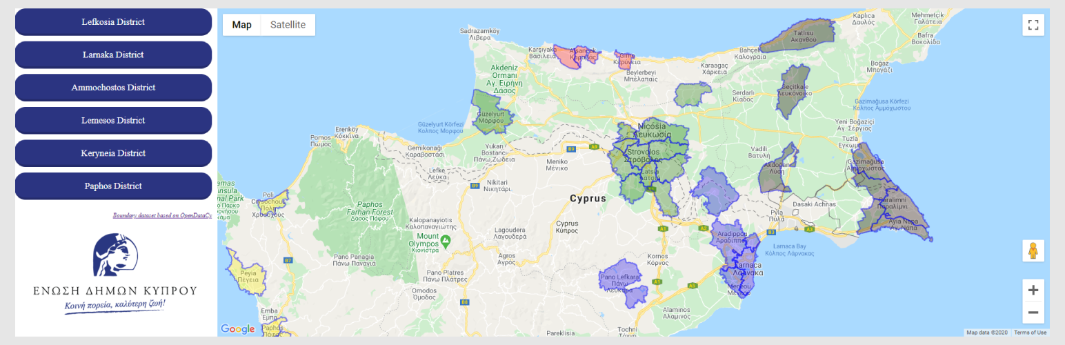
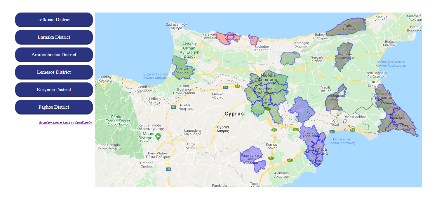
Municipal Boundaries is a simple plugin that renders current Cyprus Municipal Boundaries (as of 05/2020) on a Google Map. The dataset is provided AS-IS and is based on an optimised set of KML data from OpenDataCy. For more information about the data, please refer to their respective pages Provincial Administrative Boundaries and Map of the Borders of Local Authorities of the Republic of Cyprus at OpenDataCy.
Languages supported: Greek, English
Plugin requires a Google Maps Api key. In case Google Maps Api is already loaded into your theme or from another plugin, do not provide the Api key in Plugin Settings.
Once plugin is configured, you may place "[municipal-boundaries-map]" shortcode in your editor or file.
屏幕截图:
常见问题:
How does it work?
By placing the shortcode [municipal-boundaries-map] in your content editor or in your templates by using <?= do_shortcode('[municipal-boundaries-map]') ?>.
How can I customize design?
You can overwrite the CSS rules for .mmap-wrap, .map-container & .map-legend classes.
Is the basic UI provided responsive?
Yes.
更新日志:
1.1.3
- Data updated.
- Bugfixes.
- Improved KML Data.
- District boundaries are now rendered.
- Added KML Base URL option in settings in case of remote kml files loading.
- Improved KML Data.
- Initial release.