
Yardluma - Backyard Layout Visualiser
| 开发者 | martinj123 |
|---|---|
| 更新时间 | 2026年10月29日 11:54 |
| PHP版本: | 7.4 及以上 |
| WordPress版本: | 7.1 |
| 版权: | GPLv2 or later |
| 版权网址: | 版权信息 |
详情介绍:
Let customers see how your product could fit in their backyard.
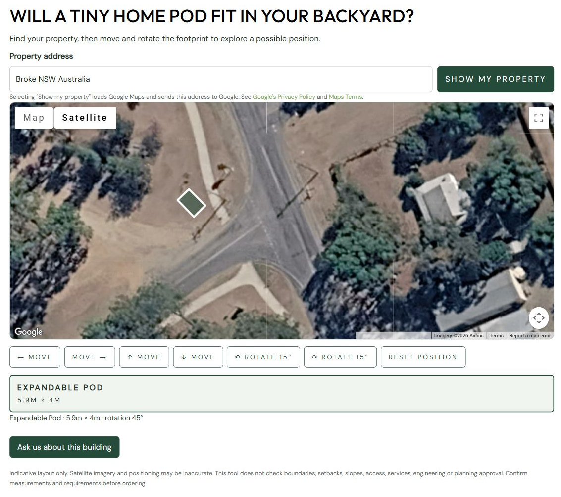
Yardluma - Backyard Layout Visualiser adds an interactive satellite-map tool to your WordPress
website. Visitors enter a property address, then move and rotate a scaled rectangular
footprint to explore where a tiny home, shed, garden studio, garage or swimming pool
could go.
Free includes:
- One rectangular model with a name, length and width you set.
- Dragging, directional movement buttons, rotation and position reset.
- Your choice of button and footprint colours, heading and introductory text.
- An enquiry button linking to your contact or enquiry page.
- A shortcode for pages, posts and Elementor Shortcode widgets. Dimensions are entered in metres. The free version remains useful indefinitely; no plugin licence key or Freemius account connection is required for Free features. There are no customer-facing upgrade adverts.
安装:
- Install the plugin using Plugins > Add New, or upload its ZIP.
- Activate Yardluma - Backyard Layout Visualiser.
- Open Settings > Yardluma.
- Set your model dimensions, appearance and enquiry page URL. Dimensions are the full footprint in metres, including any expanded sections.
- Supply your OWN Google Maps browser key. Enable Maps JavaScript API and Geocoding API, enable Google billing, and restrict the key by website/API.
- Review the Google service/privacy information and enable the map setting.
- Add [yardluma_visualiser] to a page or Elementor Shortcode widget.
屏幕截图:
更新日志:
0.3.0
- Renamed to Yardluma with a distinctive plugin slug.
- Added unique Yardluma prefixes to declarations, settings, hooks and assets.
- Preserved existing settings, shortcode embeds and private saved layout links.
- Prepared the Free package for WordPress.org review.
- Moved Premium map controls into the separately distributed add-on.
- Escaped numeric input attributes and updated setup documentation.
- Added Freemius account, Premium activation and update integration.
- Free remains usable without a licence; Premium settings survive expiry.